Open spaces and footpaths
- The Woodgate Pocket Park
- Pipers Field and Jubilee Garden
- Bishops Meadow
- Springfield (Millennium) Wood
- Footpaths
- Trees
- Wildflower verges
- Where are all these places?
Recreation Ground
The Recreation Ground lies at the centre of the village on The Clappers - the stretch of road between the High Street and Northbridge Street. It provides a large open space for games and general recreation and houses the village football pitch. It is also used for other occasional events and celebrations, including the annual bonfire and fireworks display in November organised by the Robertsbridge Bonfire Society and the annual Summer Event organised by a group of volunteers, including Councillors and other interested residents.
There is an enclosed playground with modern play equipment for younger children and an adjacent open area with several items of equipment suitable for older children. There are also several pieces of adult exercise equipment. A small car park houses the pavilion which provides changing facilities for sports clubs, and public conveniences which are open daily.
Whilst there are no public footpaths across the Recreation Ground, there is access to the adjacent Pocket Park and the public footpath that runs between the two (16a), giving access to the wider footpath network. But please remember that dogs must be on a lead throughout the Recreation Ground, are not allowed in the enclosed play area, and you must clean up after your dog (The Public Spaces Protection Order (No.1B) (Rother District Council) Order 2024.
The Woodgate Pocket Park
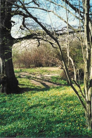 The Pocket Park lies to the north of the Recreation Ground beyond the reinstated Rother Valley Railway (RVR) embankment. Within its 2.25 acres the site contains a pond of ecological interest with flag iris and water-forget-me-not, dense areas of blackthorn scrub which are covered in blossom in spring and in autumn are laden with sloe berries, and a mosaic of grassland and riverbank habitats. There are also a number of mature , broad-leaved trees including ash, oak, maple and hazel.
The park is owned by the Council except for the old Mill owner's garden area alongside the river which was leased from SCATS (the Mill) in 1995. In this part it is possible to find the remains of an old footbridge over the river and old fruit trees remain from the former garden. Practical conservation management, including coppicing hazel trees, is carried out by members of the Volunteer Working Group.
The entrance to the park is via the public footpath (16a) from the Clappers/Northbridge Street, or the Recreation Ground, then under the reinstated RVR railway line. Once inside there are a number of informal paths kept open by periodic cutting of the vegetation which also helps to provide a range of habitats for birds, insects and mammals. Ducks and moorhens can be seen on the river, and occasionally kingfishers. Other species include field grasshoppers, dark bush cricket, dragonflies, speckled wood butterfly and common lizard.
The Pocket Park was renamed the Woodgate Pocket Park following the death in December 2018 of popular and well-know resident Jill Woodgate. For many years Jill, and her husband Roy, ran the village newsagents in Station Road (now the Village Store) and Jill was a major contributor to the quality of village life, as an active participant in many village groups. She was also a Member of the Parish Council for some years and actively helped in clearing footpaths and conducting guided walks etc.. During that time she was the instigator and driving force behind the establishment of the Pocket Park, from an unused and previously derelict piece of ground. Over many years, Jill and Roy (and often their children) spent many, many evening and weekend hours hard at work clearing and creating the park, to establish the lovely community amenity it is today. Jill was a parish Tree Warden for many years and maintained a keen interest in the park right up to her death. Naming the park after her and Roy was felt to be a very fitting way to commemorate such a valued member of the community.
You are welcome to visit the park at any time but please respect the plants and animals that live there. And if you would like to help out on the volunteer group, please contact the Clerk for details.
To keep the area lovely for everyone (including children playing off the paths) please clean up after your dog (The Public Spaces Protection Order (No.1B) (Rother District Council) Order 2024).
Pipers Field and Jubilee Garden
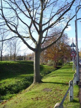 This area of approximately 2 acres lies along Station Road and was purchased by the Parish Council in 1998. A number of covenants were imposed on the sale by the previous owners to ensure that the land remains as public open space.
Some years ago, willow trees were planted in the area by Gray-Nicolls to be harvested for cricket bat manufacture. A few have been harvested and a dead one removed.
In 2003 some of the area was taken up with a flood embankment as part of the village flood defences (Robertsbridge Flood Alleviation Scheme) but after completion the area restored well to its role as a valuable green area for the use of the village.
The small triangle of land divided from the rest of Pipers Field by the Willowbank road, was dedicated by the Parish Council in 2002 to commemorate the Golden Jubilee of H.M. Queen Elizabeth ll and therefore became the Jubilee Garden. The land was subject to some upheaval during the installation of a major new water pipeline, so the garden was not actually completed and formally opened until 2005. It was funded by a generous grant from South East Water and Southern Water. The wooden sculpture (affectionately known as Noah) was carved by Sue Nunn and commissioned by Robertsbridge Arts Partnership, to be donated to the parish to mark the completion of the Flood Defences in 2004.
To keep the area lovely for everyone (including children playing off the paths) please clean up after your dog (The Public Spaces Protection Order (No.1B) (Rother District Council) Order 2024).
Bishops Meadow
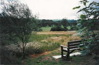 This area of land (approximately 10 acres) was formerly part of the Stenning's Woodyard which, before its closure in 1986, occupied this site and the site across Bishops Lane which is now Mill Rise. When development permission was sought the land was offered to Rother District Council as a public open space. In 1995, the Parish Council acquired the land from Rother DC on a very long lease and is now responsible for its maintenance.
A number of mature trees were already growing around the edge of the site and before the developers gave up the site a certain amount of tree planting was done; more have been planted since by the parish council. Over the last few years, the grassy areas have developed into a natural wild flower meadow. Since the 2nd WW Britain has lost over 95% of its wild flower meadows, partly through intensive farming methods, partly through development and also partly by over-picking of the flowers. The parish council decided to develop this area to encourage the wild flower meadow. A small area at the lower end of the field is kept cut short for informal children's play and rustic climbing-log type play equipment has been installed but the bulk is kept as meadow.
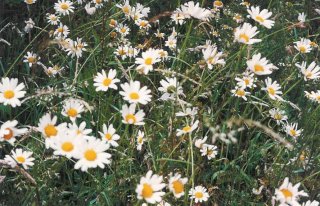 These meadows require management, mainly by cutting only after the flowers have seeded and removing the hay and of course, not using any weed killer. Many species of plant have emerged and apart from the obvious ox-eye daisies, in the spring and summer you can find bird's-foot trefoil, stitchwort, yarrow, mallow, ragged robin, meadow sweet and many more including, the occasional common orchid. Allowing the grass to grow during spring and early summer also provides a good habitat for moths, butterflies and other insects and for mice and shrews which in turn are an important source of food for owls and other predators.
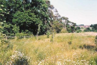 As the meadow develops it will attract more and more flower species and perhaps even larks or other ground nesting birds which require undisturbed conditions during the nesting season. There has been a dramatic decline in the population of these birds during the last decade or so. Many species of bird can already be seen in and around the meadow and during the summer months, house martins will be seen skimming the tops of the long grass and scooping up insects to feed their young.
There is an official public footpath running diagonally through the field from NE to SW and paths are cut around the edges of the meadows. There is also a 'permissive path' in the SE corner which links the Glottenham public footpaths and which is there by agreement of the Darvell community. The footbridges were installed by volunteers from the village.
You can help this area develop, by keeping to the paths and leaving the meadows undisturbed. Remember, the flowers need to be left to seed to provide future plants and food for wildlife. We also have volunteer work days to keep the meadow in top condition; if you would like to be involved please contact the Clerk for details. Thank you, enjoy your meadow.
To keep the area lovely for everyone (including children playing off the paths) please clean up after your dog (The Public Spaces Protection Order (No.1B) (Rother District Council) Order 2024).
Springfield (Millennium) Wood
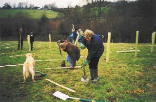 The wood occupies 12 acres of land on the northern edge of the village. The raising of the money for its purchase and planting was organised by the Robertsbridge Millennium Committee by public subscription and grants from Parish Council, District Council and other sources. It is part of an initiative called 'Woods on your doorstep' by the Woodland Trust and ownership and maintenance is now vested in them..
Approximately 10,000 trees were planted in the area and planting started on 14th February 1999 when more than 150 village residents, young and old, braved a cold, damp day to help with the planting.
The wood is open at all times.
Footpaths
Footpaths are the responsibility of East Sussex County Council but the parish contributes to small repairs and clearing operations. We have a very active Footpath Volunteer Group in the village who work hard to help keep our paths accessible. The group seeks to improve the rights of way network in our parish, facilitate access to it and promote its use by all and would welcome further volunteers either to help directly with maintenance tasks or in other less strenuous ways. If you would like to get involved or simply find out more you can email Jenny Gilbert, the Footpath Volunteer Group Coordinator here or contact the Clerk. There is a book of local walks written by local resident David Allen which can be purchased from village shops:"Walks in Salehurt and Robertsbridge" If you find a problem with a path either report it to the Clerk or directly here Please give details of the location of the path or, better still, use the official path number - copies of the Definitive Footpath maps for the area are held at the Council Office and can be inspected there. Or visit the ESCC website and view the online map.
To keep the area lovely for everyone (including children and other dogs) please clean up after your dog (The Public Spaces Protection Order (No.1B) (Rother District Council) Order 2024).
Trees
Volunteer tree wardens across the country are involved in planting schemes, surveys, school projects or planning issues affecting protected trees. They volunteer directly for parish and town councils. Caroline Knight and Graham Grimmett are the Volunteer Tree Wardens for our Parish. If you wish to contact them please email.
Wildlife verges
Verges in the Parish are maintained by East Sussex Highways. It is possible for anyone to apply for a verge to be designated as a wildlife verge. An application form can be found here

The Public Spaces Protection Order (No.1B) (Rother District Council) Order 2024 makes it an offence not to clear up after your dog on any public area in the parish, not to have your dog on a lead in the Recreation Ground, or to take a dog into the enclosed children's playground.
Please be a responsible dog owner - dog waste bins are provided at nine points in the village:
Recreation Ground car park; Bishops Meadow entrance; Jubilee Garden in Station Road, Langham Road junction with Knelle Road, The Clappers - start of footpath 16a which leads down between the cricket pitch and Rother Valley Railway, Church Lane - roundabout end, under the trees, outside Salehurst Church, at the start of the public footpath, top of Fair Lane before the footbridge over the A21 and George Hill at the junction with the Bishops Lane cut-through.